

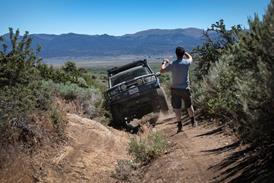
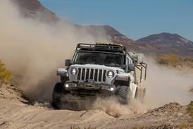
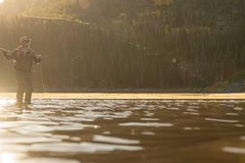
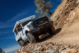



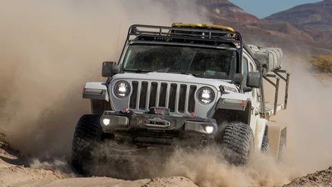
In the Northern Nevada desert, history isn’t buried very deep. We joined Jeep Jamboree USA on their 7th Annual Emigrant Trail Adventure to retrace the Applegate-Lassen — the notorious ‘Death Route’ that lured thousands of gold-rush pioneers into one of the most punishing landscapes on the continent. Some never made it out.
The Death Route: Jeep Jamboree USA’s Emigrant Trail Adventure
Retracing the Applegate-Lassen Emigrant Trail through Nevada’s Black Rock Desert and High Rock Canyon.
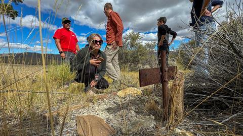
“They found the skeleton over there, partially poking out of the embankment.”
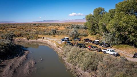
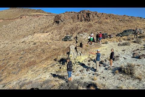
Our Jeep Jamboree USA Emigrant Trail Adventure had brought us to Clapper Creek, a wash in the Northern Nevada desert. Steep and barren escarpments rose north and south, and a sprawling valley blanketed with sage extended westward.
“The murders happened at dawn, April 26, 1859,” I shared with our small group, detailing what is known about the untimely demise of Ed Clapper and Pete Lassen, and the enduring speculation surrounding the lone survivor and only witness, Lamericas Wyatt.
But Lassen and Clapper were not the first souls laid to rest in this desolate wasteland. This was the Black Rock Desert, and less than a mile yonder lay a wagon track that bears ol’ Pete’s surname, the infamous Applegate-Lassen Emigrant Trail—aka, The Death Route.
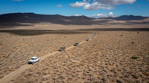
A few days earlier we were parked on the banks of the Mary’s River (Humboldt) near Lassen Meadows (modern-day Rye Patch Reservoir). My co-driver, Will Corbett, and I had joined Jeep Jamboree USA’s 7th annual Emigrant Trail Adventure, an off-road journey tracing the wagon routes of the 19th-century westward migration. Having traveled the area for more than 30 years and studied its history, I would be sharing some of its intriguing narrative over the coming days.
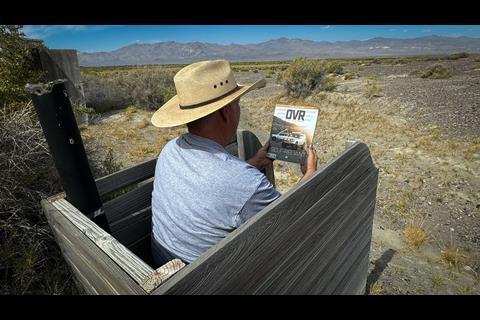
The soil underfoot was significant. Here, the California Trail split, leaving wagon masters with a decision that could mean life or death. To the left lay the feared 40-mile Desert (see our Carson Trail overlanding feature in OVR Issue 7), rife with deep sand, little vegetation, and no water.
To the right lay an enigma, a new and unproven track rumored to have plenty of water, ample grasses for livestock, and to shave 200 miles off the trip to California’s gold fields. After traveling more than 1,300 grueling miles in wagons or on foot at a rate of 10 miles per day, temptation was high.
“We started early and soon came to forks of the road. We took the right hand road, leading nearly due west, towards a gap on the mountain. The river and old road bore off to the south west.” —Elijah Preston Howell, 1849
Manifest Destiny and the Road West
The term Manifest Destiny has been deeply embedded in the American lexicon for nearly 200 years. It defined the conviction that the United States should occupy and control North America from the Atlantic to the Pacific.
The first known use of the term was in 1845 by John L. O’Sullivan, the outspoken editor of the Democratic Review who subscribed to the Jacksonian theory of expansionism. That ambition disregarded the Indigenous nations already living across the continent, while portions of the West remained under Mexican, British, or Russian control.
Nonetheless, hardy folks, many of whom had immigrated from Europe in hopes of a new life in a new land, headed west. Far from familiar towns and support, they carried their worldly possessions in wagons and handcarts, crossing the Great Plains, the Rockies, and the expansive deserts of the Great Basin.
Choosing the right fork, we made our way up to Antelope Pass, veering off to pay our respects to Susannah McCord Coon. A few months pregnant when she and her husband left Illinois, the frontier was no place to birth a child. Robert E. Coon was born on August 11, 1860, but Susannah did not survive. A few yards away lay the bones of Jas Bailey Cook, reportedly killed in an attack in 1862.
“On the right had of the road… are some willows and singular rocks, where water has lately been found by digging about four feet.”&xA0;—Israel Lord, Sept 14, 1849
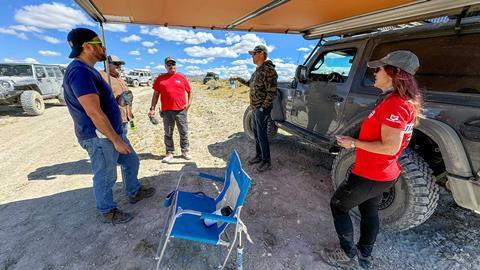
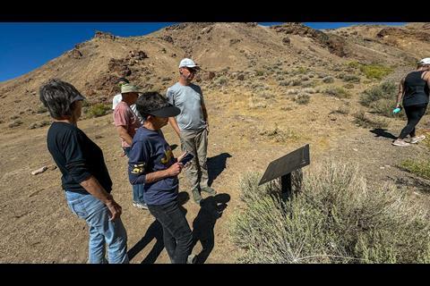
At the pass we stopped to read one of the railroad-tie signposts erected by Trails West, each engraved with journal entries from the pioneers. This entry confirmed that the first few trains found suitable grass and water. But as we ventured west the accounts began to paint a different picture.
Applegate, Lassen, and Nevada’s Death Route
Jesse and Lindsay Applegate, settlers from Willamette Valley who had each lost a son to the Columbia River during their arduous journey on the Oregon Trail, were determined to establish a safer route to the Northwest.
In 1846 the two headed south, crossing Northern Nevada and eventually arriving near the place we were parked on the Mary’s. Emigrant traffic to Oregon was fairly light for the next two years, and a number of wagon trains successfully traversed this route with limited trouble.
“Great numbers of rabbits came around us and we killed all we wanted of them. This is the place always since known as Rabbit Hole Springs.” —Lindsay Applegate, 1846
But in 1848, Danish emigrant Pete Lassen, who held a Mexican land grant north of Sutter’s Fort (Sacramento), saw value in enticing settlers to his region.
He linked a spur off the Applegate Trail to his ranch and talked a wagon train into following him. It ended in disaster when, on the edge of starvation and frostbite, they needed to be rescued by another group bound for Oregon.
Regardless, he sent reports of his “new and shorter” route to eastern newspapers. In January of that year, James W. Marshall, while constructing a mill for John Sutter, discovered gold along the American River. Although Sutter tried to keep it a secret, there is many a slip between the cup and the lip.
Word leaked out via a San Francisco newspaper, and the news rushed eastward like wildfire across the prairie. Eastern publishers, eager for the scoop on big news, printed every scrap of gossip available and pushed Lassen’s embellishment out to the public as etched-in-stone gospel.
By the spring of 1849, gold fever was reaching epidemic momentum as hundreds of wagon trains lined up in Council Bluffs, Iowa, or Independence, Missouri, to strike it rich.
With the cannibalistic Donner Party tragedy of 1846 fresh on everyone’s minds, Lassen’s alternative to the California Trail became the subject of many campfire debates.
Rabbithole Spring to the Black Rock Desert
Most wagon trains in early 1849 took to the established path, conventional wisdom dictating, “Better the Devil you know than the Devil you don’t.” But on August 11, well-respected frontiersman Milton McGee turned his group up the Applegate-Lassen.
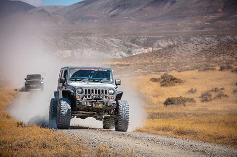
The next wagon train followed, as did the next, and so on. It is estimated that 7,000 to 9,000 pioneers, roughly a third of that year’s migration, made the fateful decision to follow McGee’s lead.
“Visited the springs to see what they look like by daylight. These were mere drippings—percolating from small clay cliffs in the hollow slope of the mountain. Travelers had dugout hollow reservoirs below each spring, which filling enabled the animals to drink.” —J. Goldsborough Bruff, 1849
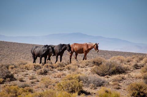
Several mustangs meandered away as we pulled up to “noon” at Rabbithole Spring, stopping for a midday break. It would have been 15 miles since the emigrants’ last source of water or grass, and by September, Rabbithole would have little to offer.
Beyond lay the baked expanses of the Black Rock Playa. Returning to the Mary’s was a risky proposition, but again, it was the Devil they knew. With empty barrels and stores nearly exhausted, most pushed on.
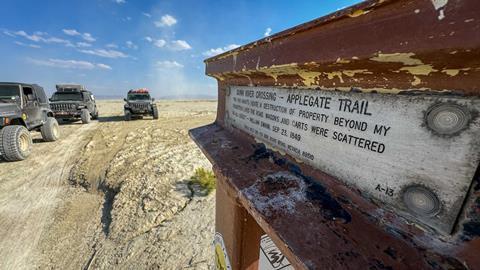
“We were badly prepared to take a desert, our cattle not having had much grass or rest for several days, and we having no grass with us, and little water. Mr. Linville and his company, two wagons, went back and the remainder went forward.” —Elijah Preston Howell, 1849
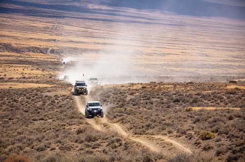
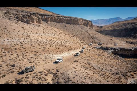
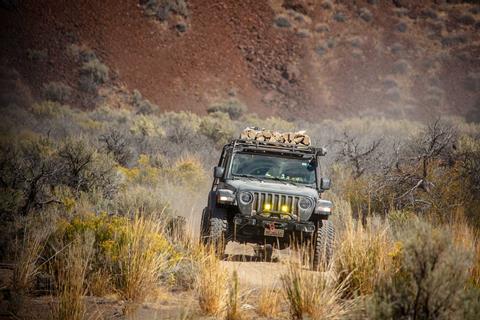
Setting our sights on the Black Rock, a volcanic monolith protruding from the north end of the playa, we drove across an anvil-flat dry lake. Overlanding in the Black Rock Desert brought us onto the same exposed playa the wagon trains had crossed, with the distant rock still serving as a landmark.
In 1843, explorer John C. Fremont was the first documented non-Indigenous explorer to travel this region. Commissioned by the government to find an alternative route to South Pass, Wyoming, he and guide Kit Carson continued west to High Rock Canyon and south to the alkali dry lake before us.
“Our New Year’s Eve was rather a gloomy one. We continued down the valley, between a dry-looking black ridge on the left and a more snowy and high one on the right. Our road was bad along the bottom, being broken by gullies and impeded by sage, and sandy on the hills, where there is not a blade of grass, nor does any appear on the mountains. During the day we directed our course towards a black cape, at the foot of which a column of smoke indicated hot springs.” —John C. Fremont, 1843
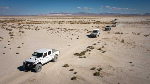
By the time the wagon trains reached the playa, their livestock had been without water and feed for several days. Oxen, suffering from dehydration and enticed by the allure of water at the edge of a distant mirage, charged off in a state of delirium only to collapse at their final resting places.
Their human counterparts became equally desperate. Without beasts of burden to ferry their wagons, they picked up what could be carried and set out afoot.
“We resumed our journey, finding a worse state of things as we travelled on. Hundreds of dead cattle and mules were lying along the road. The stench from them was almost intolerable, and could not be avoided.” —Amos Batchelder, Sep 15, 1849
Black Rock Hot Springs and Murder at Clapper Creek
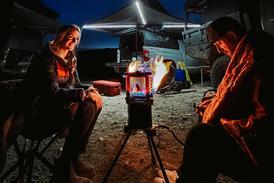
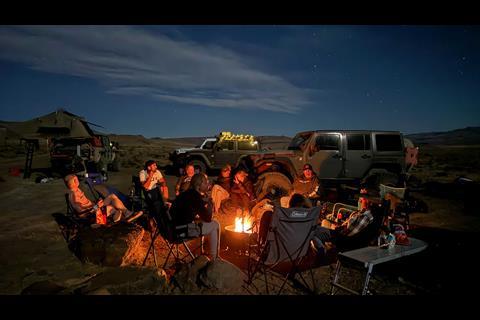
Setting up camp near Black Rock Spring, we settled in for a night of grilling, campfire yarns, and libation. Far from the light pollution of any major city, a hundred constellations chased the moon west across an inky abyss.
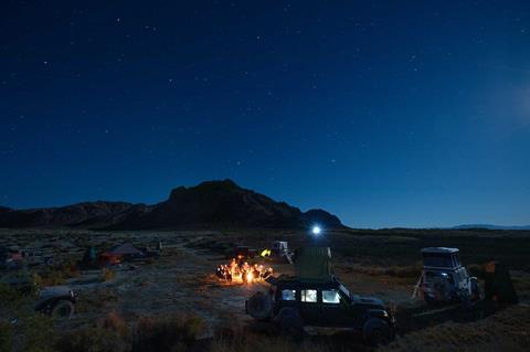
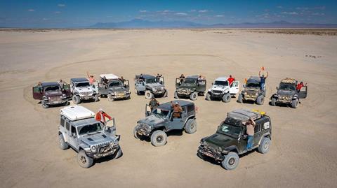
Our guests, who had come from all over the country, marveled at the remoteness of this desert oasis. For the pioneers and livestock that survived, the spring’s water and grasses were desperately needed, and they’d spend several days here recuperating before moving on.
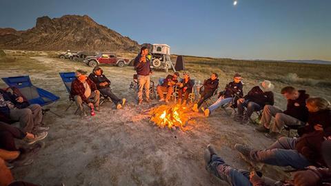
In the morning, Tammy Romero, one of Jeep Jamboree USA’s guides, wrangled a group to partake in her traditional Black Rock yoga class.
Will and I, not sure our bodies would contort in such a way, gracefully bowed out, instead opting for a cuppa joe and a healthy plate of fried bacon and eggs.
With the playa in our rearview mirror, we followed the trail north to Double Hot Springs. Its steaming water recalled the “column of smoke” Fremont noted in his journal.
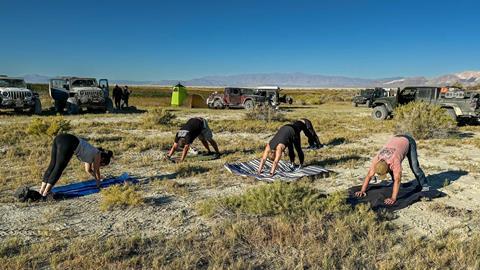
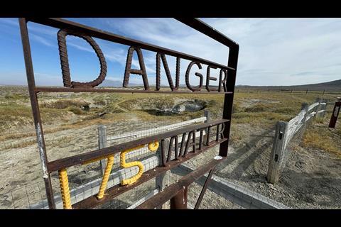
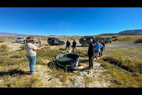
A few years later it was used by the pioneers to cook fowl and boil coffee. While its turquoise-blue depths are a thing of beauty, many souls have been lost by slipping off the steep edge. At the time of our visit, water from the spring was piped into a large agricultural tank downstream for soaking.
“There are many camped here & are guarding the hot springs… but they had not found them all and three of four oxen were found in them Boild in the morning… one of the best oxen in one of the peoria teams was Cooked.” —Jonas Hittle, 1849
Farther north we stopped at the remains of Hardin City, one of the many boom-and-bust towns of the Gold Rush. During his 1849 migration, James Hardin dug up an ore sample while hunting in one of the canyons.
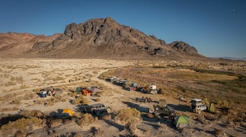
Having it assayed in Sacramento, results were good and he returned in 1858 in an attempt to locate it. He was unsuccessful, but rumors of the rich Hardin Strike circulated and eventually prompted Lassen, Clapper, and Wyatt to do a little prospecting.
Lassen and Clapper were dead, but whodunit? Wyatt blamed Paiute people for the killings and claimed to have grabbed nothing but his rifle before riding 48 hours straight to get help.
When a search party located the bodies, however, nothing appeared to be missing. Some contemporaries questioned Wyatt’s account, including Fred Kingsbury, the son of Lassen’s partner William Kingsbury.
“When Indians kill they want something for it. They take anything and everything in sight. Nothing was disturbed, not even the food in camp, or Peter’s pocketbook, containing his money. It wasn’t an Indian job.” —Fred Kingsbury (son of Lassen’s partner William Kingsbury)
This place at the base of Clapper Creek will forever be referred to as Murder Rock, but the whodunit will remain a mystery.
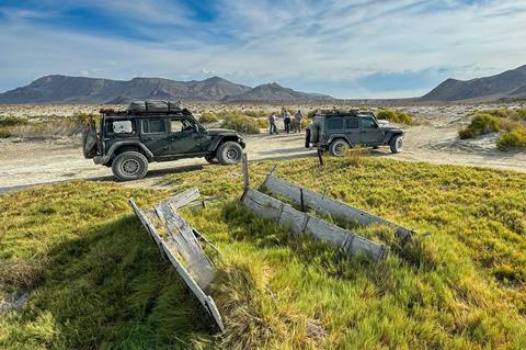
Soldier Meadows and Fly Canyon
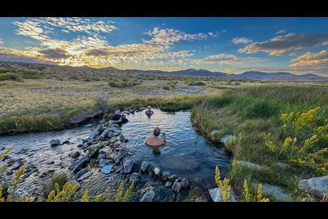
We were taking a dip in Hot Creek as the sun was setting on the west rim of Soldier Meadows, Nevada. The valley was once home to Camp McGarry, an 1865 cavalry post established near Summit Lake during the Indian Wars but relocated to the meadow due to its milder climate.
Built to house more than 100 soldiers and officers, stone quarters, offices, and an armory were constructed, some of which are still standing on the now-private ranch.
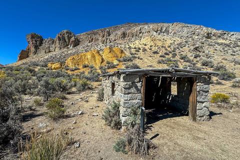
Much of the surrounding valley is public land, with camping options for travelers exploring this part of Northern Nevada. We took time to visit the Rancher Cabin, a community warming hut managed by the Bureau of Land Management (BLM).
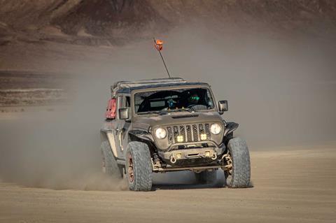
With multiple sources of fresh water and ample grasses for livestock, settlers would have again replenished their stores and repaired wagons prior to attempting the next leg of their journey… Fly Canyon.
“Nearly all the trains which had preceded us were encamped on the beautiful oasis, recruiting their worn-out animals, and cursing the hour in which they were tempted to leave the old trail. The first agreeable news we heard on getting in, was, that the Indians were very bold and troublesome, having succeeded in the night before in killing a horse and mule in the camp, and driving off several head of cattle.” —Alonzo Delano, 1849
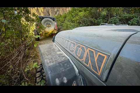
If the hardships of the Black Rock had not shattered the 49ers’ spirit, Fly Canyon would test their fortitude. While we benefited from an established two-track, early travelers resorted to dismantling their wagons or lowering them down near-vertical ledges by rope.
“I’m looking back; it seemed amazing that wagons and teams could descend safely. The declivity, and its base, retain vestiges of unfortunate traveling, in the shape of broken wagons, wheels, hubs, tires, axles, and three dead oxen.” —J. Goldsborough Bruff, 1849
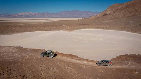
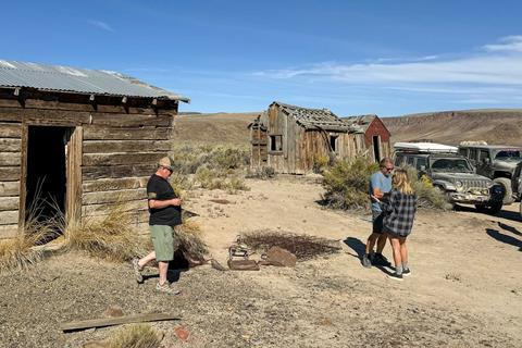
The canyon opens to a shallow valley and perennial High Rock Lake. We took time to explore several cabins, relics from the various ranching empires that controlled the area from 1870 to the 1960s. Beyond lay High Rock Canyon, one of the more storied sections of the Applegate-Lassen.
High Rock Canyon and Stevens Camp
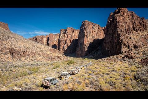
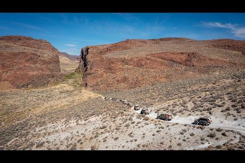
From a chalky white ridge, we funneled into what appeared to be an impasse. Vertical walls rose hundreds of feet to each side and the path became barely wide enough to squeeze through.
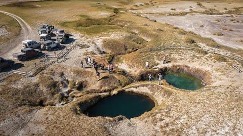
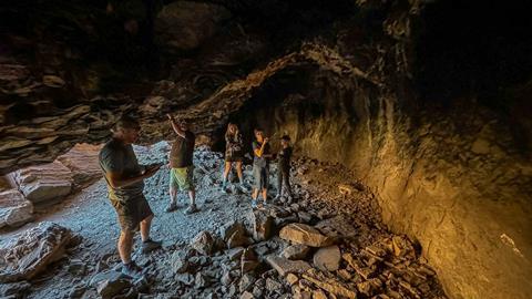
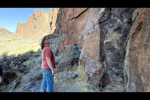
The narrow passage left wagon trains vulnerable; emigrant accounts described attacks from the canyon walls above. Stopping to inspect a large cave, we realized we were not the first to seek shelter from the elements here.
The area’s earliest inhabitants certainly utilized this place, and the etchings of settlers can be found along the base of the precipice.
“We encamped in a canyon, or very narrow gorge. On the north side are stupendous perpendicular rocks rising to a height of 300 feet. At its base is an entrance to a cave. Its walls are blackened with smoke and it has undoubtedly been inhabited by Indians.” —Amos Batchelder, 1849
On emerging from High Rock Canyon we arrived at Stevens Camp, another historic but more modern artifact of the region.
Fremont noted the spring in 1843, and in the coming years it would be owned by the State of Nevada, rancher Hugh Glenn, Miller and Lux (largest cattle operation in the West), and even country singer Tennessee Ernie Ford.
Gerlach and the Nobles Trail
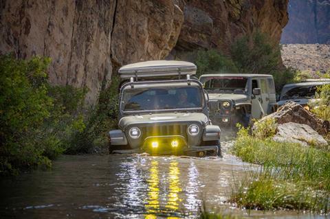
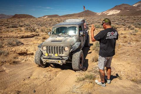
We said farewell to the Applegate-Lassen Emigrant Trail at Stevens Camp and headed south to the remote town of Gerlach, where we picked up the Nobles Trail, established in 1852, through the Smoke Creek Desert for our final night’s camp. Jeep Jamboree USA’s Emigrant Trail Adventure had carried us from the Humboldt River through the Black Rock Desert and High Rock Canyon, with each stop adding another chapter to the story.
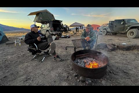
A culinary feast of steak, brats, veggies, and coldies around the fire sparked dialogue on the cascading series of events and people that led us to this spot: Milton McGee, Susannah Coon, Lassen and Applegate, and the dozens of pioneers whose journals survived to help tell their story.
We also reflected on the Paiute people who had occupied this land since time immemorial, only to be displaced by Manifest Destiny. The journals preserved the emigrants’ experiences, but theirs was only part of the region’s history.
The following morning we paused at the end of the valley where the Nobles Trail turned up a narrow canyon and disappeared toward Honey Lake. Honey Lake, that sounded like an interesting place… but that would be a tale for another day.
Jeep Jamboree USA on the Applegate-Lassen Emigrant Trail Image Gallery
Access More Great Stories!
This article originally appeared in OVR Issue 13. For more informative articles like this, consider subscribing to OVR Magazine in print or digital versions here. You can also find the print edition of OVR at your local newsstand by using our Magazine Finder.


No comments yet